NRCS WEPS/RUSLE2 Training - Hosted by MAEAP
Date and time
Location
Michigan State University Agronomy Farm - Large Conference Room
4450 Beaumont Rd Meridian charter Township, MI 48910Description
MAEAP is partnering with NRCS to host the WEPs and RUSLE2 Trainings for FY 2018. This will be an opportunity to learn more about the tools and how to evaluate erosion risk. The training will include classroom instruction and computer work and will be taught by Jerry Grigar from NRCS.
The expected audience is MAEAP technicians and other Conservation District staff. This is a CORE training for MAEAP technicians.
Bring a computer pre-loaded with NRCS software if available. Instructions for downloading software below.
Wind Erosion (WEPS)
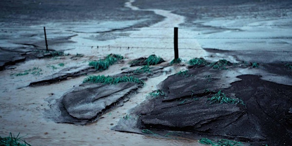
Soil erosion by wind is a serious problem in the United States and the world. Wind Erosion can be a threat to agriculture productivity and the sustainability of the earth’s natural resources. The erosion of surface soil by wind renders the soil less productive by removing the most fertile part of the soil, namely, the clays and organic matter. This removal of clay and organic matter reduces native productivity of the soil and damages soil structure and biological activity, which are essential soil qualities for a healthy soil resource.
In addition to soil loss, wind erosion can damage plants, primarily by the abrasive action of saltating particles on seedlings and fruits. Eroded soil can also be deposited into waterways where it impacts water quality and/or emitted into the air where it degrades the air resources. By affecting these resources, wind erosion can also become a health hazard to humans and other animals.
The ability to accurately simulate soil loss by wind is essential for, among other things, environmental and conservation planning, natural resource inventories, and reducing air and water pollution from wind-blown soil materials.
Revised Universal Soil Loss Equation 2 (RUSLE2)
RUSLE2 is used to evaluate potential erosion rates at specific sites as well as guide conservation and erosion control planning. RUSLE2 uses factors that represent the effects of climate (erosivity, precipitation, and temperature), soil erodibility, topography, cover-management, and support practices to compute soil erosion. Conservation planning concepts must be understood and implemented into the RUSLE2 program in order for this program to work effectively.
Instructions for dowloading software:
RUSLE 2 is available from the PURDUE National Soils Lab Website. http://fargo.nserl.purdue.edu/rusle2_dataweb/RUSLE2_Index.htm Installation instructions are also there. The model comes with a generic Moses database but it is not the ones we use in MI. Depending on what office they are in we have a Moses database for each area 1-4. The Moses database can be found on the S. drive under NRCS at the local service center. All PCs at the office share the same Moses database this way.